From Ground to Cloud: Turn Data into Action
Optimizing construction workflows, SIGNAX showcases the power of drone surveys and software solutions to handle Radius Group’s engineering tasks

Project overview
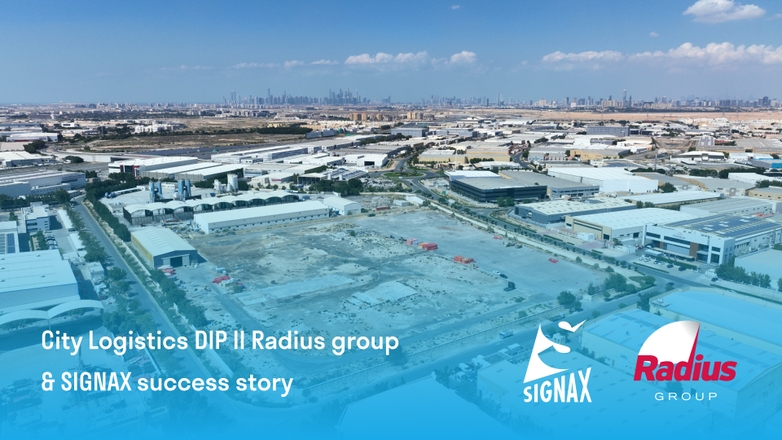
Radius Group City Logistics @DIP II, Dubai, UAE
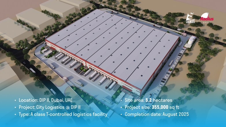
City Logistics @DIP II is a 32,900 sq.m. (GFA) temperature-controlled logistics facility located on a 5.2-hectare site at Dubai Investments Park. The facility consists of four independent blocks, each with its own fitted-out office entrance groups. Developed to meet Class A institutional standards, this project is designed to serve as a high-quality logistics hub in the UAE.
Introduction
SIGNAX recently took part in an innovative project by Radius Group, utilizing drone technology, ground inspections, advanced photogrammetry, and cutting-edge software to optimize the client’s operations. The project aimed to address the following key objectives:
- Enhance environmental planning
- Connection of engineering systems
- Identifying and selecting various site masterplan configurations
- Calculating earthwork volumes
- Construction management plan (CMP) development
- Preparing documentation and reports for regulatory approvals
- Deliver compelling visuals for stakeholders
Through careful execution and data processing, we helped the client make informed decisions, streamline operations, and improve their project’s visibility in the market.
1. Preparation Phase
The project began with a comprehensive analysis of the site’s condition and the goals at hand:
- Goal
The primary objective was to improve site preparation and stakeholder coordination by providing precise data and actionable insights. This included identifying opportunities to repurpose leftover concrete slabs and aligning landscaping plans with both environmental guidelines and project requirements.
- Solution
SIGNAX initiated preparations to address these needs by planning and performing drone photogrammetry works, coordinating with all relevant government authorities, ensuring clear communication channels, and setting objectives for both site preparation and mobilization and planning green spaces.
Key actions included:
- Selecting drones and software capable of creating precise data for both topographic analysis and vegetation planning
- Developing a clear schedule for drone flights and ground inspections in alignment with construction milestones
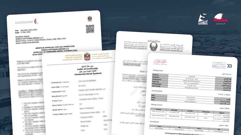
- Obtaining all the required approvals and NOC from government and local authorities
2. Field Operations
Field works in the construction site were focused on aerial and ground-level data collection:
- Goal
The objective was to achieve complete and precise site data collection, including consistent and accurate elevation measurements, particularly in hard-to-access areas, to support effective planning and decision-making.
- Solution
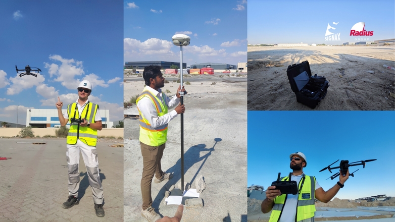
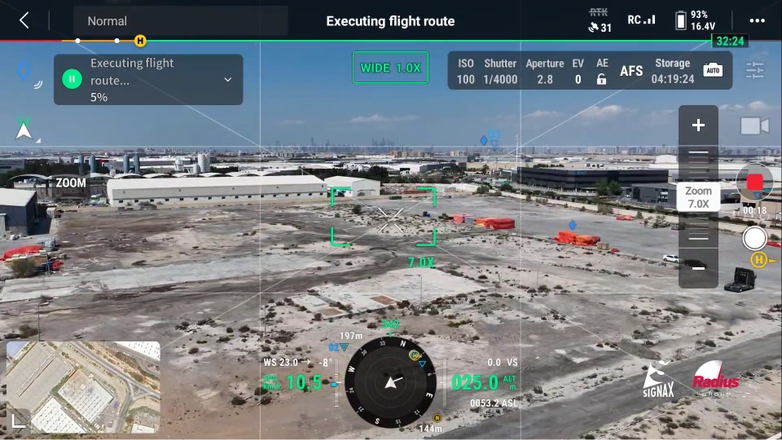
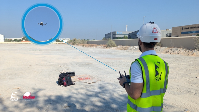
Aerial. SIGNAX deployed drones for two aerial surveys in March and November 2024, capturing high-resolution imagery and elevation data using photogrammetry. For better coordination - SIGNAX used ground control points that were coordinated using best-in-class survey equipment to achieve centimeter accuracy of point cloud and masterplan.
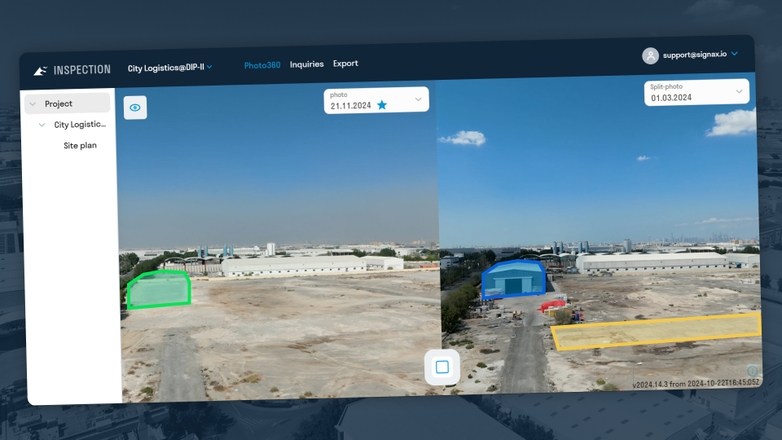
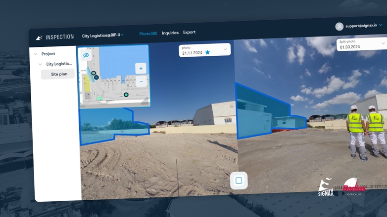
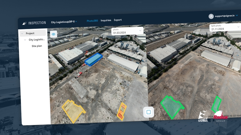
Ground. Simultaneously, ground inspections during the same periods provided detailed insights into specific zones of interest, enabling comparison of panoramic photos taken on the same spot from different dates.
Highlights of our approach:
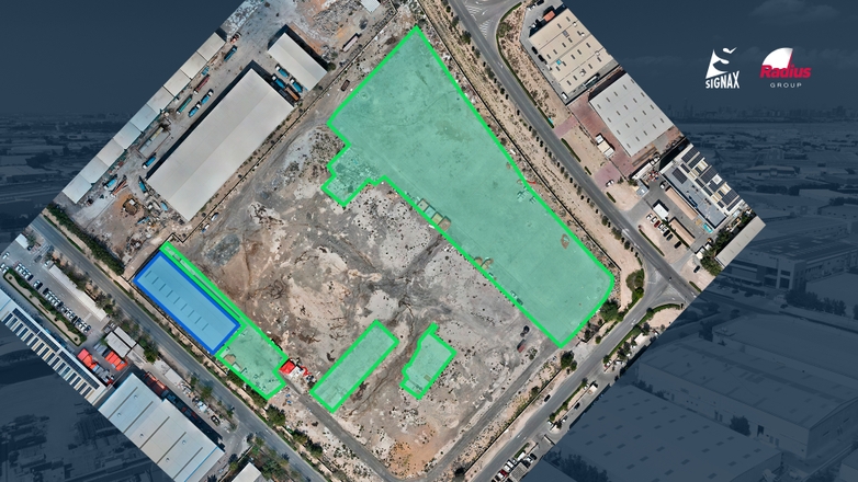
- Drone flights were planned to cover the entire site while focusing on zones and areas selected for landscaping
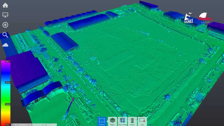
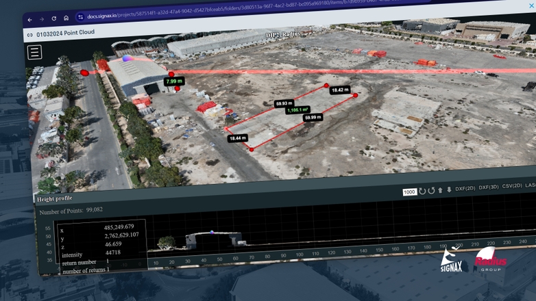
- Photogrammetric data was processed to generate accurate point clouds, ensuring no detail was overlooked
- Ground inspections validated aerial findings and provided an extra layer of detail for actionable recommendations
3. Material Preparation
Transforming raw data into actionable insights was critical to help client achieve their goals:
- Goal
The objective was to convert raw data into clear, actionable visuals that would support the client in effective planning and decision-making. Additionally, there was a need to create informative and engaging visual materials to communicate progress and insights to stakeholders worldwide.
- Solution
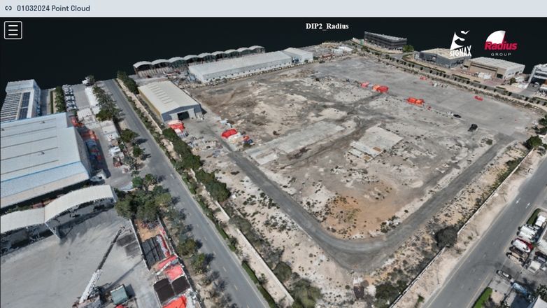
We processed the photogrammetry data and created a highly detailed point cloud using specialized software. Ground control points were carefully coordinated, combining data from the ground with precise coordinates obtained through advanced survey equipment.
For seamless collaboration and accessibility, the point cloud was uploaded to SIGNAX DOCS, enabling stakeholders to view it from any device. Additionally, ground photos were uploaded to SIGNAX INSPECTION, ensuring easy comparison and visualization of the site’s details.
Deliverables included:
Detailed Point Cloud. High-resolution point cloud showing construction site area and landscaping.
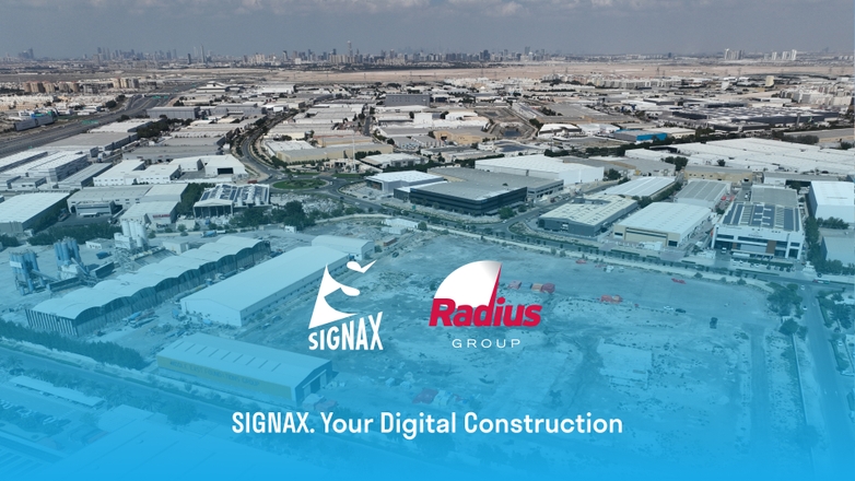
Marketing-Ready Photos. Professionally performed high-res photos from drone showcasing progress to investors and stakeholders.
4. Use Cases and Benefits
The results of the project directly impacted the client goal and stakeholder engagement:
- Goal
The objective was to streamline contractor mobilization and expedite landscaping approvals by providing precise data and actionable insights. Additionally, there was a need to enhance project presentations for stakeholders and potential investors with engaging and informative visuals.
- Solution
SIGNAX’s services and solutions enabled:
Site Preparation Acceleration. The photogrammetric analysis pinpointed exact locations and scopes of work, allowing contractors to mobilize quickly and efficiently.
Marketing Impact. Engaging visuals and reports improved the client’s ability to present their project to potential investors and stakeholders.
The project highlighted SIGNAX’s ability to transform complex data into actionable insights, empowering the client to make informed decisions and maintain project timelines.
Conclusion
In conclusion, this project demonstrated how SIGNAX’s services, including 360-degree photos, photogrammetry, and cloud-based construction management tools like INSPECTION and DOCS, effectively transform raw data into actionable insights. These solutions bridge the gap between complex site data and practical decision-making, and help stakeholders visualize progress and achieve their goals.
SIGNAX is committed to driving innovation in construction and site management, offering our clients services and tools they need to achieve success.
