Making BIM as great power of construction phase
How to manage digital data flow on site, make construction model and control project with help of digital services


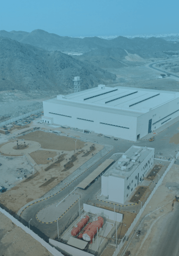
Bastech company is an EPC contractor of the first factory in Fujairah, UAE to manufacture Basalt Fiber Rebar. The construction part is one of the most important. As Bastech had BIM models as a result of the design stage, it was absolutely consistent to use and to have maximum value out of it on site. SIGNAX team helped a customer with it.

Case 1
Challenge: Coordination of disciplines
Numerous changes in one discipline of the BIM model should be coordinated in the others to prevent outdated information in drawings and also prevent potential clashes inside a single or between several disciplines.
Solution: BIM consulting on-site, use of Revit server
SIGNAX team helped to successfully encounter this problem by starting to deliver their on-site BIM consulting services. From the very first day, they provided training to the client, which helped them deeply understand aspects of Autodesk and SIGNAX software. The client was also introduced to Navisworks, BIM 360, and SIGNAX TOOLS functions.
Furthermore, the construction BIM model was developed and updated during the whole stage. It helped to speed up the project development process and dramatically reduce collisions. Additionally, deploying a Revit server enhanced collaboration within the team: brought real-time synchronization of the BIM model, and allowed multiple team members to work on different disciplines simultaneously, minimizing clashes and maximizing productivity.
The combination of on-site BIM consulting and using a Revit server proved to be a successful strategy in overcoming the challenges associated with a highly dynamic information flow, resulting in efficient and timely project development.

Case 2
Challenge: Masterplan drawings are not actual
The site’s landscaping and utilities were carried out without an up‑to‑date master plan, the as‑built documentation for these works was provided late, and the design decisions were behind the construction works. This problem led to challenges in coordinating utilities and landscaping, resulting in delayed decision‑making on the construction site. It necessitated a significant amount of time to conduct site inspections and become acquainted with the existing conditions and construction updates.
Solution: Regular aerial drone surveys, panoramic capturing
Specialists of the Digital Survey Department organized regular flights of the construction site with the preparation of orthomosaics, Digital Elevatio Models (DEM), and points clouds, which allowed up‑to‑date and operational information on the work performed on the site, increased the team’s understanding of the project’s current work and reduced site inspections time by 40%.
Panoramic and drone pictures helped to visualize construction progress for meetings not only for the on-site team but also for meetings with remote teams.
Orthomosaics revealed inaccuracies in the current landscaping works and corrected them before completion, which shortened the time for their reworks. Using orthomosaic has made it possible to maintain a current operational plan of utilities and networks.
Point clouds and DEMs made it possible to calculate the volumes of dumps near the construction site, which allowed more accurate planning of material procurement and production.
Case 3
Challenge: Tracking works dynamics and project progress
Obtaining real-time and accurate data from the construction site for daily progress reporting is a significant challenge. Data collection by classic report methods may lead to delays and potential inaccuracies and not always depict the visual nuances of construction progress. Maintaining consistency and standardization in daily logs across various teams and subcontractors can be difficult.

Solution: 360‑degree photos by SIGNAX INSPECTION software
Comprehensive Visual Documentation: 360‑degree imagery provides a complete visual record of the construction site from all angles. It can be invaluable for tracking progress, identifying discrepancies, and conducting virtual site inspections.
Enhanced Communication and Collaboration: sharing 360‑degree imagery with stakeholders allows for better communication and collaboration with the help of comments and issues features. All parties involved, regardless of their location, can virtually visit the site, enabling clearer discussions and informed decision‑making.
Improved Accuracy in Analysis: by having a detailed and accurate visual representation of the construction site at various stages, the project manager and team analyzed progress more effectively. The BIM model comparison feature aided in identifying potential issues early, optimized workflows, and made data‑driven decisions to keep the project on track.
Case 4
Challenge: Difference between as‑built and shop drawings. Not enough data for Digital Twin
One of the customer’s requirements was the development of a Digital Twin of the plant, for which it was necessary to combine shop drawings, as‑built documentation, and real‑time sensor data. The survey of MEP systems inside the building was not carried out; as‑built documentation was developed without taking into consideration in‑place changes and not enough data regarding rising pipes and duct elbows. As a result, the actual situation in the facilities differed from that in the drawings.


Solution: 360‑degree photos by SIGNAX INSPECTION software
SIGNAX surveyors performed two iterations of laser scanning of the facility. The first iteration is performed at the moment of installation of MEP systems, the second iteration is done after completion of the architectural finishing.
Point clouds allowed BIM department specialists to model missing communications, and point clouds allowed them to show the actual crossing and position of MEP systems. Point clouds data was stored on the SIGNAX point cloud web‑viewer that was able to use data for all project stakeholders without installing specialized software to utilize point clouds for everyday work.
Another crucial result is the improvement of as‑built documentation quality and the accurate calculation of the scope of work.
